Home
Cruise
Observatories
Operations
Student Projects
Gallery
Poetry
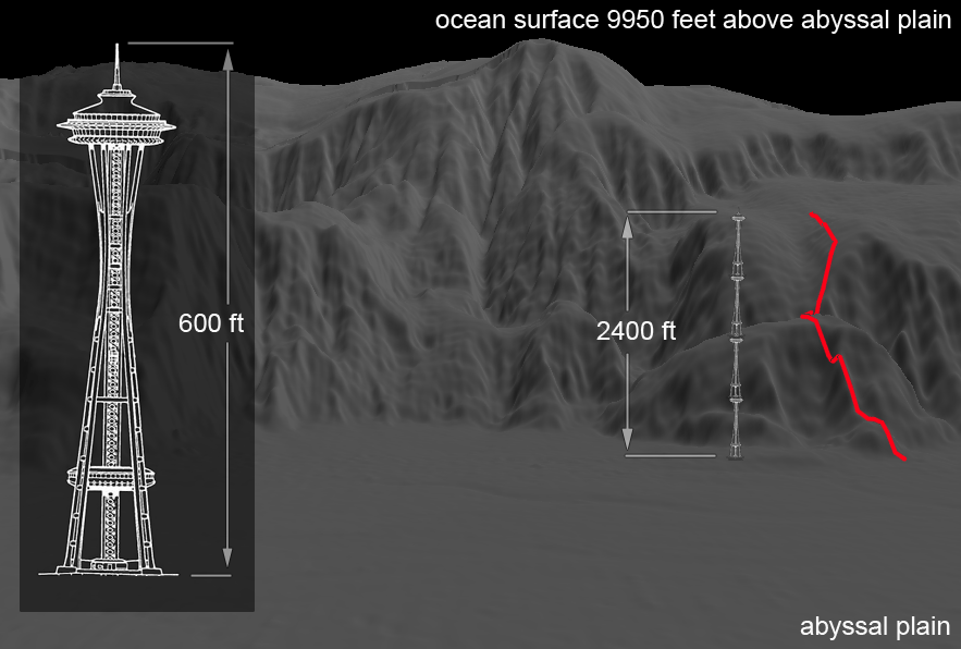
Title: Hydrate Ridge Climb Measured in Space Needles
File Type: Image
File Size: 228 kb
A rendering of the “tectonic front” that represents the build up of sediments on the edge of the North American continent. The point of view is from the deep, flat abyssal plain that is underlain by the Juan de Fuca tectonic plate. The TowCam trackline (shown in red) begins at 2911 meters water depth on the abyssal plain and terminates at 2160 meters water depth. Put in another perspective, Hydrate Ridge measures four Space Needles tall.
Date: 2008-08-01
 Image Usage Guidelines