Home
Cruise
Observatories
Operations
Student Projects
Gallery
Poetry
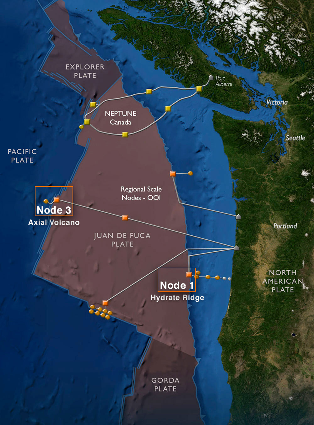
Title: The Regional Scale Nodes cables and node sites and the complementary NEPTUNE Canada obsrvatory program.
File Type: Image
File Size: 219 kb
The Regional Scale Nodes component of the National Science Foundation’s Ocean Observatories Initiative—and the complementary NEPTUNE Canada program—will be associated with the Juan de Fuca tectonic plate, one of a dozen or so major plates that make up the surface of the Earth.
Fiber-optic cables will run from shore landings to experimental sites (orange dots) located in areas of highest scientific interest. The observatories will operate 24/7/365 and will provide unprecedented remote access to the ocean, the seafloor, and the subseafloor.
Detailed mapping sureys of Nodes 1 and 3 highlighted in this figure, were accomplished during the InSite08 OOI mapping cruse.
The Juan de Fuca plate is roughly triangular in shape and measures 830 km on its easternmost edge, 530 km on the western edge, and 450 km in width. The area to be instrumented is approximately 250,000 km2
Date: 2008-07-14
 Image Usage Guidelines